Bernina Express Route
Bernina Express Route
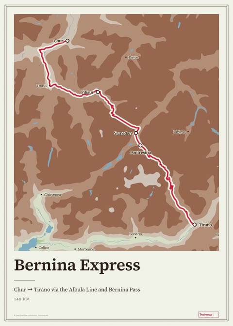
Chur → Tirano via the Albula Line and Bernina Pass
Routes on this map
The Bernina Express is the Rhaetian Railway's panoramic train from Chur to Tirano. It crosses the Alps in about 4 hours, over 196 bridges and through 55 tunnels, and tops out at Ospizio Bernina, 2,253 m, the highest railway crossing in Europe. The whole climb is made by adhesion, with no rack, on a line that has been a UNESCO World Heritage Site since 2008.
Route facts
| Duration | ≈ 4 h Chur–Tirano (St. Moritz–Tirano ≈ 2 h 15)1 |
|---|---|
| Distance | 148 km, with 196 bridges and 55 tunnels2 |
| Highest point | Ospizio Bernina, 2,253 m; the highest point of the RhB network3 |
| Gradient | Up to 70‰ (7%) with no rack, among the steepest adhesion railways in the world3 |
| Operator | Rhaetian Railway (RhB)1 |
| Reservations | Compulsory on train and connecting bus; CHF 36 high season / CHF 32 low season (2025/26)2 |
| Fares (2025/26) | Chur–Tirano CHF 96 (2nd) / CHF 164 (1st); last-minute offers from CHF 79 incl. reservation. Book at rhb.ch4 |
| Season | Year-round; connecting Bernina Express Bus to Lugano runs March–October4 |
| Line opened | 5 July 1910; UNESCO World Heritage since 7 July 20085 |
Height along the route
Scenic highlights
- Landwasser Viaduct. The best-known structure on the Albula line, near Filisur. The train leaves a tunnel in the cliff face and runs straight onto the curved stone viaduct, 65 m high. Side to sit: right heading south, left heading north (Seat 61).4
- Montebello Curve. Near Pontresina the line turns to face the Morteratsch Glacier below the Bernina massif.6
- Ospizio Bernina & Lago Bianco. The highest point of the line, at 2,253 m, where the track runs along the shore of the Lago Bianco reservoir on the Bernina Pass. Side to sit: right heading south (Seat 61).3
- Alp Grüm. At 2,091 m, where the steep descent into Val Poschiavo begins, with views over the Palü Glacier.4
- Brusio Circular Viaduct. A 116 m spiral viaduct built only to lose height. On the last descent to Tirano the train loops round and crosses over its own track.5
Stations on this route
- Chur
- Filisur
- Samedan
- Pontresina
- Tirano RhB
UNESCO inscribed the Albula and Bernina lines in 2008 as "exemplary of the use of the railway to overcome the isolation of settlements in the Central Alps". According to the World Heritage listing, the 61 km Bernina pass line alone has 13 tunnels and galleries and 52 viaducts and bridges. Trains run all year, through meadows in summer and deep snow in winter.
“Perhaps the most scenic Alpine train ride… although the Glacier Express competes for the title.”
Mark Smith, The Man in Seat 614
Related routes
Sources
Facts last checked 18 July 2026 · About Trainmap · All iconic routes
Map style
Everyday
Elevation
Classic
From space
Built by Arinbjörn, sometimes on a train · About
About & credits
Rail data: OpenStreetMap contributors (ODbL)
Stations: Trainline, Nominatim
Maps: OpenStreetMap contributors via Protomaps, self-hosted
Terrain: EU-DEM (Copernicus), USGS, NOAA et al.
Powered by MapLibre GL JS