Trainmap → Interrail
Map your Interrail route
Put every leg of your trip on one map, each drawn along the railway it runs on rather than as a straight line between cities. It’s free, it works in your browser, and the map is yours to keep and share.
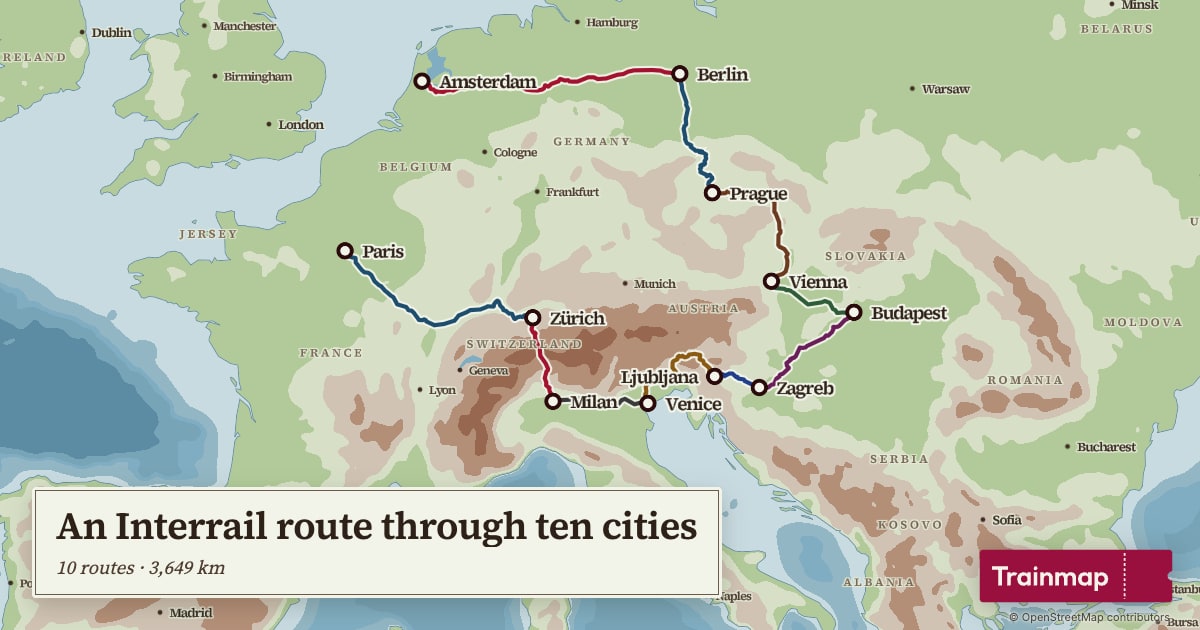
How to map your Interrail trip
- Add each leg, station to station. Type where you got on and where you got off: Amsterdam to Berlin, Berlin to Prague. If your train took a particular line, add a station on the way.
- Every leg is drawn along the real tracks, over the Alps, along the coast, under the Channel, and the distances add up as you go.
- Name the map and share it, as a link anyone can open or as a picture for a story or the group chat. There are a dozen map styles, from a clean modern map to 1920s railway posters, and you can design a poster of it.
Already logging your trips?
If you record your journeys in Trainlog or Träwelling, or your phone keeps a Google Maps Timeline, you can import them and see the whole trip at once.
Four classic Interrail routes
Each one opens in the map maker, ready to change: add your own stops, take a leg out, or start your trip from home.
-
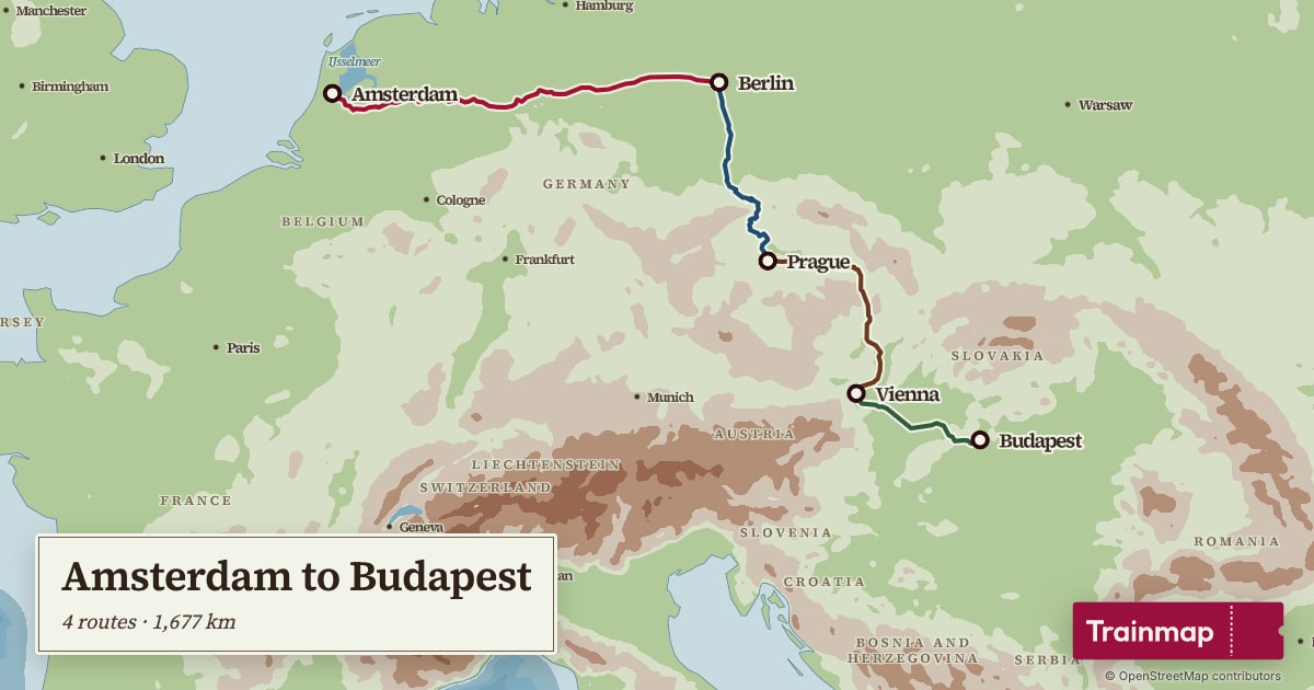
Amsterdam to Budapest
Four legs across the middle of Europe: Amsterdam, Berlin, Prague, Vienna and Budapest.
-
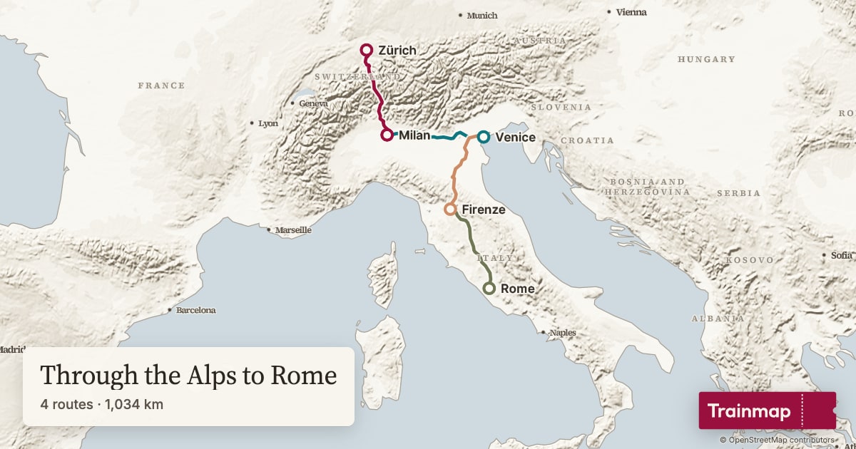
Through the Alps to Rome
Zürich to Milan across the Alps, then on to Venice, Florence and Rome.
-
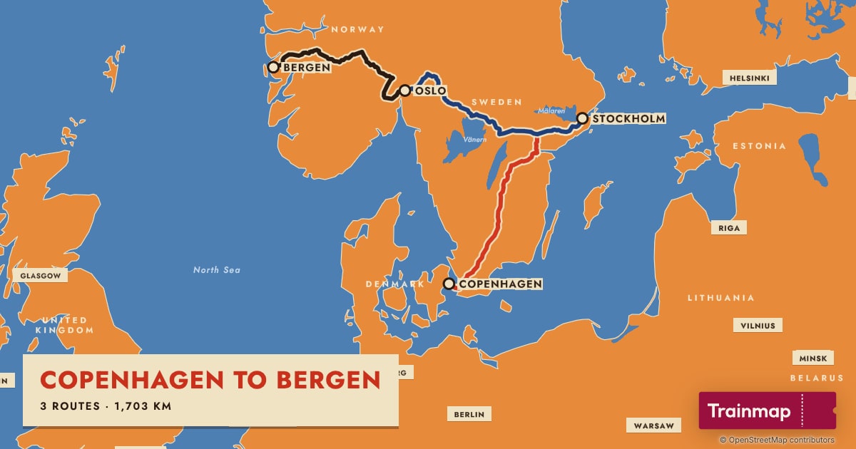
Copenhagen to Bergen
Over the Øresund to Stockholm, across to Oslo, and up over the mountains to Bergen.
-
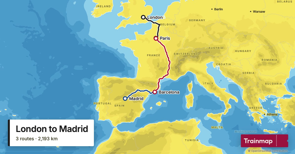
London to Madrid
Under the Channel to Paris, south to Barcelona, and across Spain to Madrid.
Questions
Can I plan an Interrail trip with Trainmap?
Trainmap maps the route: where you go and the lines you take between places. For timetables, seat reservations and your pass, use the Interrail app (Rail Planner) or the train companies' own sites.
Does it work for a Eurail trip?
Yes. Interrail is the pass for people who live in Europe and Eurail the one for everyone else; the trains are the same, and so is the map.
Is Trainmap free?
Yes, and you don't need an account. Your maps are kept in your browser, or on every device if you make a free account.
Is each leg drawn on the real railway?
Yes. Every leg follows the railway lines in OpenStreetMap, through the Alps, along the coasts and under the Channel, and Trainmap adds up the distance. Add a station on the way if your train took a particular line.
Can I print my Interrail map?
You can design a poster of your map now and reserve it. Prints aren't for sale yet.